Best Mountain Biking in Pennsylvania
Mountain biking in Pennsylvania is one of the best activities to do! And the PA Laurel Highlands is the best place in the state for it (but maybe we’re biased).
Pennsylvania’s mountain bike trails are rugged, rocky and full of roots. Many of them are maintained by small groups of volunteers who get together sporadically, so it’s not uncommon to see washed-out bridges or big trees down across the trail. But if you’re on the right bike with the right attitude, PA is an excellent place to ride.
We put together some of our favorite trails in the Laurel Highlands region. So grab your bike, wrangle up some friends, and get out there!
Ohiopyle
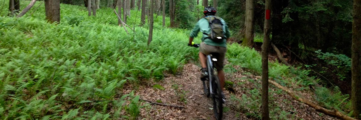
McCune Trail
Morning on McCune Trail in Ohiopyle.
McCune is one of the few short loops you can mountain bike in Ohiopyle State Park. This 3.7-mile loop has a bit of everything — some short punchy climbs, technical rock gardens, fun flowy bits and a nice overlook.
McCune is best ridden in a counter-clockwise direction. From the trailhead parking lot, ride up Sugarloaf Road and turn left onto the dirt Firetower Road. McCune trail is on the left. After climbing a bit, you’ll come to the downhill section. Let er rip and you’ll be back down to the trailhead before you know it. If you want some more, head out for another lap or continue down Sugarloaf Road to ride a loop around the new (flattish) Canyon’s Edge trail across from the snowmobile parking lot.
Best time to ride: fall, when the leaves on top of Sugarloaf Knob are changing. It’s great practice for the Month of Mud series final, the Ohiopyle Super-D, which starts on the top part of McCune Trail.
More info about Ohiopyle mountain biking from Pennsylvania’s Department of Conservation and Natural Resources.
Quebec Run Wild Area
Clockwise Quebec route
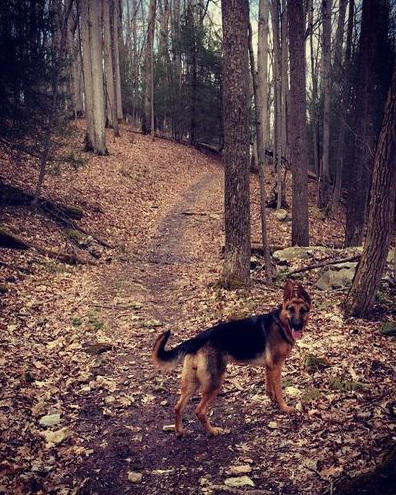
Dogs are allowed on the trails at Quebec Run, but be mindful of hunting seasons!
Quebec Run is a 7,441-acre section of Forbes State Forest south of Ohiopyle and just north of the Pennsylvania-West Virginia border. When he was surveying the Mason-Dixon Line, George Mason hiked through three miles of what is now Quebec Run. Mason described the area as “a wild of wildes: the laurel overgrown, the rocks gaping to swallow up, over whose deep mouths you may step. The whole is a deep melancholy appearance out of nature.” It’s much better now that there are some trails through the laurel.
Quebec Run has over 20 miles of pristine singletrack. People use it for hunting, hiking, cross-country skiing and mountain biking. But you don’t often run into anyone else there – especially on a weekday. Quebec is off the beaten path for tourists who’d rather take a short trip into Ohiopyle than an epic adventure in a remote place with no cell service.
A nice loop to do in Quebec is about 11 miles long, starting at the Tebolt trailhead.
Start with Tebolt Trail and descend, staying to the left at the first junction. There are a few short steep climbs and fun descents. Continue on Hess Trail until its terminus at a parking area. Part way along you’ll need to make a sharp left off a section of doubletrack to ascend a hill on the way to the final descent.
From this parking area, find the Miller Trail trailhead and get ready for some adrenaline – this is an awesome descent. Continue onto the Mill Run Trail, a flattish section alongside the beautiful Mill Run. There’s also a camping area there, which is a nice place to stop for a snack. The bridge takes you to Grist Mill Trail if you want to add a few extra miles. Back on Mill Run Trail, the track exits the valley floor and begins to climb.
Finish your ride by taking a right onto Tebolt Trail and climb some rough doubletrack back to the junction below the parking area. Go left and finish the climb back to the your car.
Find the GPX track here: https://www.mtbproject.com/trail/7001093/clockwise-quebec
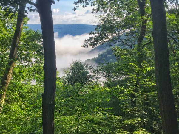
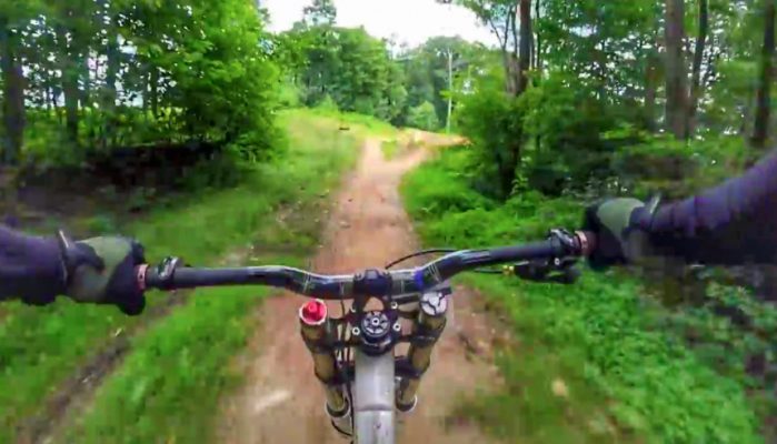
Laurel Hill State Park
Laurel Mountain Loop
(Wilderness Voyageurs bike tour guide Montana Miller cleans a rock drop on Laurel Mountain.)
This ride, just south of Ligonier, has some of the best and toughest riding in Forbes State Forest. Expect lots of rocks with good flow and not too much climbing. All the “Expert” trails here were built by members of the Laurel Highlands On & Off-Road Bicycling Association, so you know they’re good. This route is a little over 20 miles, but you can make it shorter by looping back to the trailhead on Laurel Summit Road.
This ride includes tunnels of mountain laurel and rhododendron that are green year-round, making it a great ride even in the middle of winter. The rocks here really stand out, especially the ones on Rocky Gap trail. Try to clean the section of trail that squeezes through two high rock walls.
Take the out-and-back on Wolf Rocks trail, and take a break on the outcropping to gaze out at the sea of trees and have a snack. On the way back are more skinnies and log piles, big rounded rocks and tight singletrack.
There are lots of twists and turns that are tedious to read, so check out the full route and download the GPX track here: https://www.mtbproject.com/trail/4531024/best-of-laurel-advanced
Wilderness Voyageurs does Ohiopyle mountain bike rentals! We’ve got the Cannondale Beast of the East 2, Kona Big Honzo and Gravity SS 29er mountain bikes! Call for rates and reservations at 1-800-272-4141.