Laurel Highlands Gravel Biking

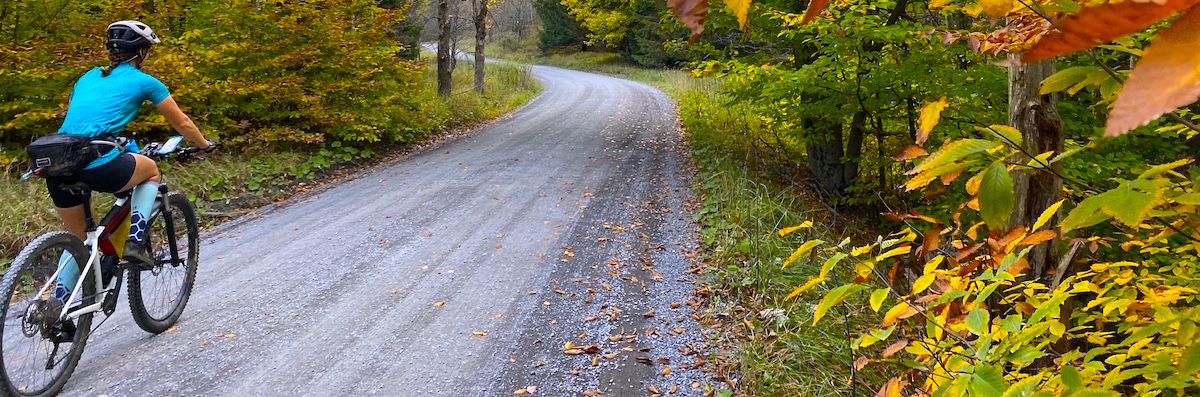
Gravel biking is one of the best ways to see some of the best roads in Ohiopyle and Pennsylvania’s Laurel Highlands. Keen gravel enthusiasts will get a kick out of the steep climbs, great views and ripping descents in this steep, green river valley. Check out these local routes to get you started on a ride from Ohiopyle. It is amazing that there is a lifetime of gravel riding located just more than an hour from downtown Pittsburgh.
FYI: Most of our gravel roads are quiet, but always wear bright clothing and use your lights!
Ohiopyle Gravel Mini Loop: 8.4 miles, 1067 feet of climbing
This route starts at Wilderness Voyageurs in Ohiopyle. As you leave town, you’ll start out riding along Meadow Run, a beautiful tributary of the Youghiogheny River. The gravel keeps going until you get to Sugarloaf Road, high above town. This part is paved, but offers a great downhill descent into Ohiopyle! If you’d rather climb pavement and descend gravel, just reverse this route for an alternative.
Falls City Pub awaits those that need food and libations.
Ohiopyle Gravel Medium Loop, 14.7 miles, 1815 feet climbing
This is a mixed surface loop with some great climbing and the route goes well in reverse! Some cool places to visit and a variety of surfaces to keep your attention.
Ohiopyle Gravel Infinity Loop, 18.4 miles, 2466 feet climbing
Starting in Ohiopyle from Wilderness Voyageurs, this ride is a mixer of great gravel climbs and big paved descents! You start onto gravel almost immediately, as you leave town. The gravel is relentless and the paved downhills will make you appreciate good bike mechanics!
Ride this in reverse to get the paved climbs and the gravel downhills if you dare. I will hold firm that going up the gravel and flying down the pavement is the way to go, for maximum suffer and reward. Just keep lapping until the food and drinks call your name over at the Falls City Pub!
Ohiopyle Mixed Surface Loop, 25.1 miles, 2355 feet climbing
This route will throw a little bit of everything at you! You’ll encounter paved 2 lane highways with traffic, paved country roads, gravel, dirt, and more. The climbing is manageable, but the variety of surfaces will keep you on your toes. Plus, there are plenty of cool waterfalls to hit near Ohiopyle!
Ohiopyle to Confluence (the hard way), 35.1 miles, 4146 feet of climbing
This loop will test your mental and physical stamina. You will be faced with some pretty big climbs circling you around the Youghiogheny river and the 3rd highest point in PA, Sugarloaf Knob. You’ll experience some amazing gravel, but you will need to earn it as you negotiate some of the area’s highest ridges! A resupply can be had in Confluence and you will be very happy to see Wilderness Voyageurs at the end of the route, mainly because the Falls City Pub is only a few short feet from here. You probably deserve a drink and some tasty food after this ride!
This route can be done in reverse to mix things up. The nice thing about this route, is that it has great bailout options! If you hit Confluence, the Great Allegheny Passage bike trail can take you back to Ohiopyle if you spent all your energy climbing the ridge. It’s about 10 miles via a slightly downhill grade along the the beautiful Youghiogheny River.
The Dead Short Course – 46.4 miles, 4200 feet climbing
We borrowed this excellent gravel route from a local bike race – The Quick & the Dead Mt. Davis Gravel Grinder. This route takes you from Confluence, up and over the highest point in the state of Pennsylvania, Mt. Davis. The course posted here is the “short” route, a 46.4 gravel endurance adventure with over 4000 feet of climbing and descending. It’s on gravel back roads, with great views of windmills, rivers and even a red covered bridge. Enjoy the ride and make sure you bring a flat kit! Those roads can be rough!
Explore Our Supported Gravel Tours!
Seneca Lake Backroads & Brews
An approachable, multi-surface ride based near New York’s largest Finger Lake, Seneca Lake.