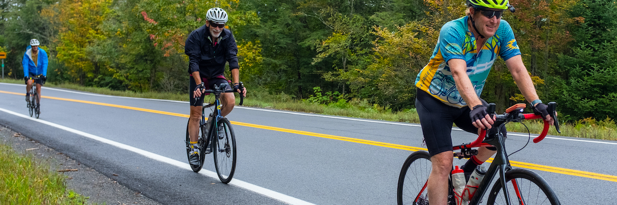
Laurel Highlands Road Biking

Road biking in Pennsylvania’s Laurel Highlands is quite an experience – these Allegheny hills are no joke! Experienced roadies and gravel enthusiasts alike will get a kick out of this area’s steep climbs, low traffic and beautiful scenery. Check out these local routes to get you started on a ride from Ohiopyle.
A couple quick tips:
- Wear bright clothing and use your lights — local roads have narrow shoulders.
- You might find that a gravel bike is best suited for our roads – the back roads here can get bumpy, and some of these routes use the Great Allegheny Passage trail. (Check out our gravel routes too!)
- Falls City Pub is a great place to refuel after your ride!
Kentuck Road Biking Route: 13 Miles, 1326 feet of climbing
Here’s an awesome climb! Climbing up Kentuck Road will seriously challenge your heart and legs. Head south out of town on Rt. 381, cross the Meadow Run bridge and turn right on Kentuck Road. You’ll cross over Cucumber Run, and then the hurt begins. The climb is short but steep. In 0.75 miles, you’ll gain about 600 feet. Here’s a nice loop once you make it up the hill: continue south on the Chalkhill-Ohiopyle road for 5 miles, turn left on Nelson road, then bear left on Gallagher Woods Road and take another left to ride downhill to Ohiopyle on Route 381.
Sugarloaf Mountain Loop, 20.7 miles, 1829 feet climbing
A local favorite is a ride over Sugarloaf Mountain to Confluence and back. You start with a lung-busting, five-mile climb on Sugarloaf Road out of Ohiopyle that gains about 1700 feet. Plan for 35 to 50 minutes to reach the top. Bomb down the mountain (looking out for pot-holes) to where Sugarloaf Road meets Route 281. Turn left on 281 and ride toward Confluence, where you can stop at the Lucky Dog Cafe and have a mid-ride margarita! Then follow the Great Allegheny Passage back to Ohiopyle, an easy 11-mile spin on the rail trail.
Gibbon Glade Grinder: 31.5 miles, +3,156 feet of climbing
This is a scenic woodland loop on back roads starting from Ohiopyle. Climb up Route 381 for some punchy hills at the start, then ride south into the woods, almost into West Virginia! (Pro tip: stop at Fuel Coffee Works for an espresso and a snack to stash in your pocket for later!) You’ll loop back up toward Dinner Bell Road, pass Tall Oaks Campground, then descend all the way back down to the river.
Highlands Scenic Spin: 21.2 miles, 1664 ft of climbing
For a ride that’s not as extreme, you’ll have to get out of the Yough River Valley. This ride starts near Donegal and follows Route 381 to Linn Run State Park. The route is rolling and passes barns, bridges and Powdermill Nature Reserve, an avian research center.
Ohiopyle Bridges and Ridges: 55.2 miles, 4565 feet of climbing
This is a seriously challenging ride that hits lots of scenic areas around Ohiopyle! You’ll start with an immediate climb from Ohiopyle, up Route 381 for a couple miles. Then turn off on a small country road, and keep on climbing! Descend Jersey Hollow Road to the first of your covered bridges for the day. If you’ve had enough already, you can bail early toward Confluence and take the GAP trail back to Ohiopyle. Otherwise, keep on climbing for more covered bridges and steep ridges! The ride ends on the GAP trail for an easy spin back to Ohiopyle.