Riding from Ohiopyle, PA to Davis, West Virginia and back
Posted by Montana
“You know it’s supposed to thunderstorm all day,” says Colleen.
“I think I’ll be alright. It might miss me,” I say.
“Ok, I just don’t want you to be miserable and come home complaining about it,” Colleen says.
I futz around, pack the rest of my stuff onto my bike. Got the camera, got my sleeping stuff, have a dry pair of underwear. No room for a rain jacket. Maybe I won’t need it. I roll out the door. No better grab it. Back in the door. I strap the jacket to the top of my bars roll away from the house again.
Up the first climb out Ohiopyle. I’m a little nervous. Davis is 75 miles away, I don’t know my route, and black clouds are puffing and sliding across the sky. I pull out the cue sheet, sweat drips off my forehead and splotches some of the ink. Nuts. I wipe my eyebrows. Can’t be doing that.
Alright, I need to go right on Glades Road, left on McCracken School. I put the sheet away. Left on Glades, right on McCracken. Left on Glades, right on McCracken. No that’s not right, right? I check the sheet again. Left on Glades, not right.
I turn left on McCracken, and ride down the road a few hundred feet. Wait, this isn’t right, I should have gone right. I spin around, and roll onto the first dirt of the day. A few miles later, I scan for my next turn. There’s an unmarked trail off to the left, but it sure doesn’t look like Mason Dixon Road. I check the map on my phone. It is. These cues are going to be impossible to follow without road signs. I tuck away the paper directions.
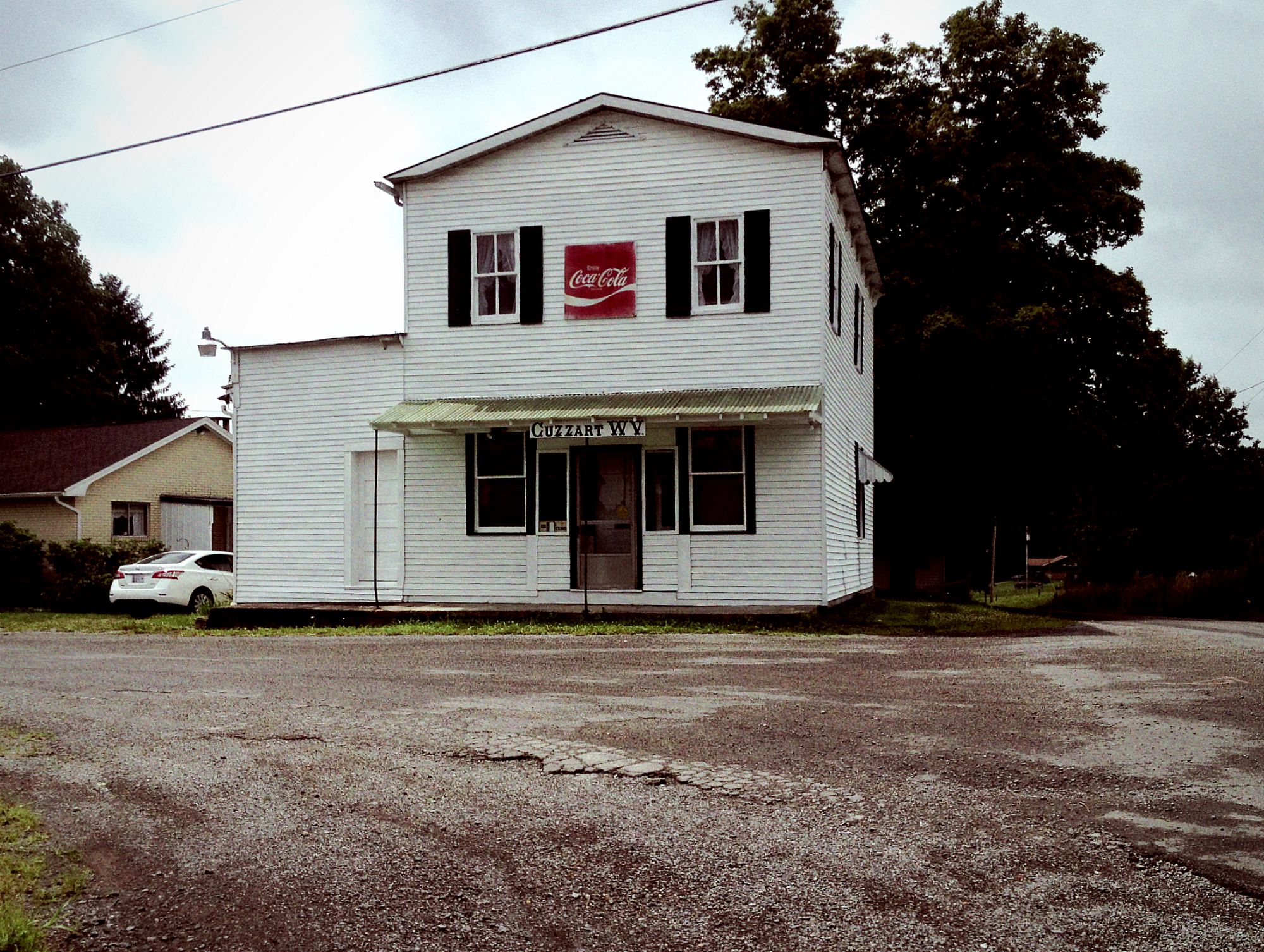
I cross the border into West Virginia, ride a bridge across I-68, and bounce down some rutted, rocky, single-lane tracks into Cuzzart.
I ride past one farm house, where the road turns from dirt to trail, and a short brown dog rushes out of a garage.
“Sit! Sit down!” I yell.
“Bark bark bark!” he yells.
“Sit the hell down!” I yell.
“Bark bark bark!” he yells.
This conversation clearly isn’t getting either of us anywhere. I pedal faster and the dog finally gives up the chase. I drop into the woods.
A puddle. With ridges, for flavor.
A few miles later, I ride past a group of eight people on five ATVs. All the people are staring at the road. I wave and say hello. They all wave back in unison and look at me blankly. Weird.
Around the next bend, there’s a black plastic hose sticking out of the dirt, pumping water onto a little pallet platform. Perfect. I was almost out of water. I fill both bottles. The sky rumbles. That doesn’t sound great. The road turns from trail to dirt to gravel to pavement. The wind picks up, grey clouds roll like waves. The hills thump and echo. I better find some shelter before this storm hits.
I run into a little pavilion next to a white church. The rain pings sharply against the metal roof. Louder, louder until I can’t hear myself talk to myself. Lighting strikes the steeple. The thunder blasts. Jesus that was close.
The storm starts to let off. I put my rain jacket on, which I’m very glad I went back for, and get back on my bike. The lightning is gone, but it’s still raining. I ride a flat gravel road over Snaggy Mountain which is more of a Snaggy Bump and hide from the rain in an old log cabin. At this point I kind of want to go home. I’m all wet and uncomfortable. Then the sun starts to come out. Oh boy. I fold up my coat and ride into the nice weather.
20 more miles of dirt and pavement until I get to the bottom of the climb into Tucker County, where I drink my last drop of water. 15 miles to go. My only food today has been a bag of peanuts, so I’m feeling a little out of gas, but I should be able to make it to the Purple Fiddle in Thomas. I start grinding up the hill.
A while later, my stomach is contracting. Gotta keep going. Beef wraps at the top. A trickle of water runs down the hillside. No, don’t stop. Just keep rolling.
I finally make it to the Fiddle, and order a beef wrap and a Seneca IPA in a mason jar and sit across from a chubby kid with eyes that are permanently sunk into his game playing thing.
After I finish eating, I get back on my bike and head for camp.
I ride out of Thomas and up the windy road a few miles to Davis. The elevated sidewalks are pretty empty for a Saturday afternoon. I roll past the Shop n’ Save on the edge of town and cross the bridge onto the dirt road that borders the Black Water River. Muted, far-off thunder booms.
Time to find a spot to camp. Up and down the road, scanning the woods. The thunder rumbles again. Man, I better find a spot quick. I scamper into the woods. This place is full of rocks. Damn. I wish I would have brought my hammock. I find a little crack between two boulders, string my tarp and blow up my sleeping pad.
I’m swarmed by mosquitoes. I swat my face and arms. They keep swarming. I need to go get some chemicals to repel these little bastards. I crash back through the weeds and onto the road, and ride back to the Shop n’ Save to get bug spray, a bomber of Torpedo, and a coffee cake.
On the way back, I walk down to the river to wash off. The water is deep orange. I cup some into my hands, it looks like iodine. I wonder if I should bathe in this stuff. Well, it’ll probably be alright. I soap up.
The storm hasn’t started yet, so maybe I can find a better camping spot. I roll up all my stuff and ride farther down the road. A few miles in, there’s a nice clearing by the river. I reset my campsite, read until the sun sets, then go to sleep.
A mosquito buzzes in my ear. I slap it. It buzzes again. I crush it against my head. Silence for a few minutes. The buzz comes back. Christ. I’m covered in deet you little beasts, leave me alone. I pull a t-shirt over my face and pass out.
I crawl out of the tarp the next morning, and into a big mass of poison ivy. That’s fantastic. I guess I’ll find out if I’m still immune to the stuff in the next few days. I repack my bike, and roll back into town to the Bright Morning Inn for breakfast. I eat a big stack of banana-walnut-blueberry-pancakes with thick cut bacon, drink four cups of coffee, then head back towards Thomas, and on to Ohiopyle.
Since my phone is out of battery, and I can’t navigate on all the confusing back West Virginia trail roads, I decide to take the more straightforward route through Oakland, Deep Creek, and Friendsville, Maryland.
I coast down out of Tucker County. Into the rolling farmland and red roads in Maryland. I’m spinning my highest gear, making great time. Through Deep Creek, up a climb then steep descent to Friendsville, then up another hill to Markleysburg. I start toward Confluence, the closest town to Ohiopyle. The road pitches up steeply, I shift into my lowest gear. I’m starting to lose energy now, I’ve come 60 miles on two bottles and one cliff bar.
Up, up, up. The road finally levels out at an old church. I pull off the road. I could climb up another 1000 feet over Sugarloaf Knob, then descend all the way back to Ohiopyle, or I could drop into Confluence, get a burger, then roll back into town on the Great Allegheny Passage Trail.
Hell, I’ll just take the mountain. It’ll be five miles shorter. I pedal a hundred feet up the road. Nope. Out of gas. I turn around and coast down the hill to the Lucky Dog Café.
After a pretty decent burger, (not as good as a Falls City Pub burger) I roll onto the GAP Trail, and burn the last 12 miles into Ohiopyle.
That was a great little mini tour. 151 miles total, a ton of climbing, and lots of time in the saddle. I’ll have to do some more of those.


