Santa Fe and New Mexico Daily Bike Tour Elevation Profile
Welcome to the Enchanted State! Here are the daily bike tour elevations. Please note: this tour does take place at high altitude. Santa Fe is situated at 7,199 feet. Drink your water and take advantage of the support stops! It’s an incredibly beautiful tour in a very special part of this country. There is no better way to explore New Mexico than by bike!
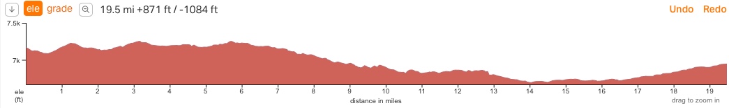
Day 1 Santa Fe:19.5 Miles exploring Santa Fe
Elevation Gain: 871 ft
Elevation Loss 1,084 ft
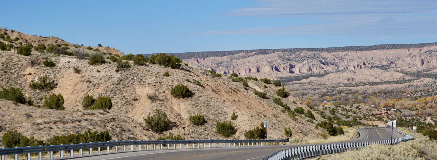
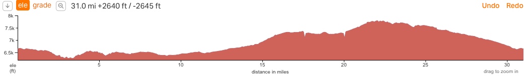
Day 2: 31 Miles Bandelier and Los Alamos (plus a day hike around Bandelier National Monument)
Elevation Gain: 2,640 ft
Elevation Loss 2,645 ft
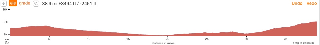
Day 3 Santa Fe to Truchas – 38.9 Miles
Elevation Gain: 3,494 ft
Elevation Loss 2,461 ft
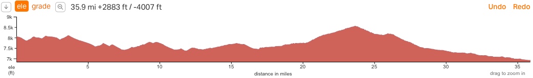
Day 4: 35.9 miles from Truchas to Taos
Elevation Gain: 2,883 ft
Elevation Loss 4,007 ft
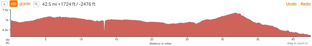
Day 5: 42.5 miles from Taos to Ojo Caliente (ahhhhh)
Elevation Gain: 1,482 ft
Elevation Loss 2,234 ft
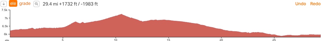
Day 6: 29.4 miles from Ojo Caliente to Abiquiu (Georgia O’Keeffe’s home)
Elevation Gain: 1,732ft
Elevation Loss 1,983 ft