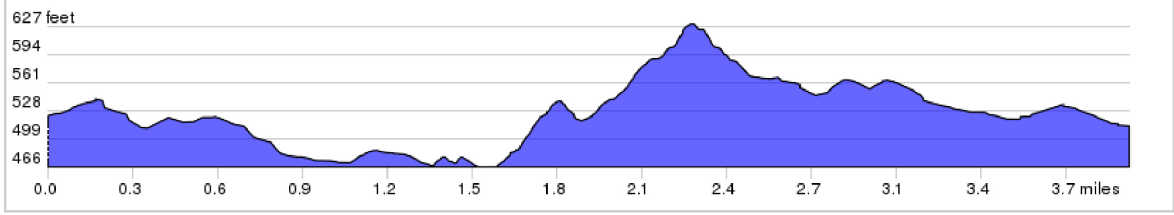
Gettysburg & The Civil War Trip Elevation Profile
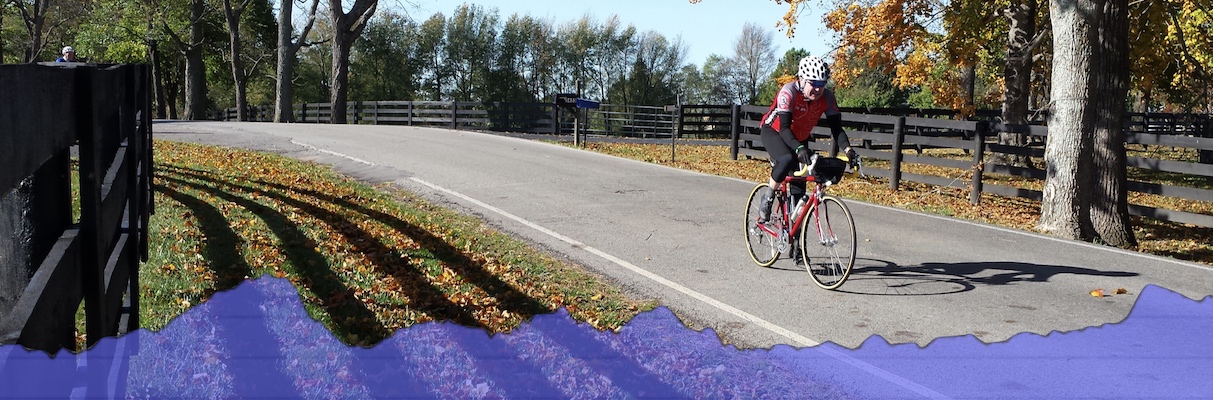
Our 4-day Gettysburg & The Civil War Tour begins on the battlefield and weaves its way through some of the area’s most historic locations. While you will run into some hills on this tour, don’t let them scare you! You have the determination and guide support to pedal on.
Below is a sampling of the ride elevation profiles from each day of the tour. This is a representative group– it may not include all ride options and it may not be the entire ride of each day. Keep in mind the scale of the image can distort both the steepness up and down of these rides.
*Please note that Day 1’s morning ride is not listed. Your tour begins with a licensed guide, who will take you through the Gettysburg Battlefield.
Day 1: Culps Hill to Brafferton
3.9 miles; + 258 ft / – 250 ft
Day 2 Morning Ride: Gettysburg to Sachs Covered Bridge

24.9 miles; + 1224 ft / – 1284 ft
Day 2 Afternoon Ride (option 1)

16.4 miles; + 699 ft / – 650 ft
Day 2 Afternoon Ride (option 2)

29.8 miles; + 1228 ft / – 1180 ft
Day 3 Morning Ride

13.2 miles; + 834 ft / – 923 ft
Day 3 Afternoon Ride

6.8 miles; + 269 ft / – 342 ft
Day 4 (option 1)

17.7 miles; + 869 ft / – 999 ft
Day 4 (option 2)

18.6 miles; + 262 ft / – 389 ft
To check out the tour overview, follow the link for Gettysburg & The Civil War details.
Wilderness Voyageurs operates bike tours around the US, choose from road rides, rail trail tours, or mountain bike tours. We are based in Ohiopyle, Pennsylvania, right next to the Great Allegheny Passage.
Wilderness Voyageurs
103 Garrett Street
Ohiopyle PA, 15470
800-272-4141